Downloaded FOR-instance Sensor ULS · UAV laser scanning Region Norway, Czech Republic, Austria, New Zealand, Australia (CULS, NIBIO, RMIT, SCION, TUWIEN) Labels Individual tree instances and semantic classes Licence CC BY 4.0 Paper FOR-instance: a UAV laser scanning benchmark dataset for semantic and instance segmentation of individual trees Download
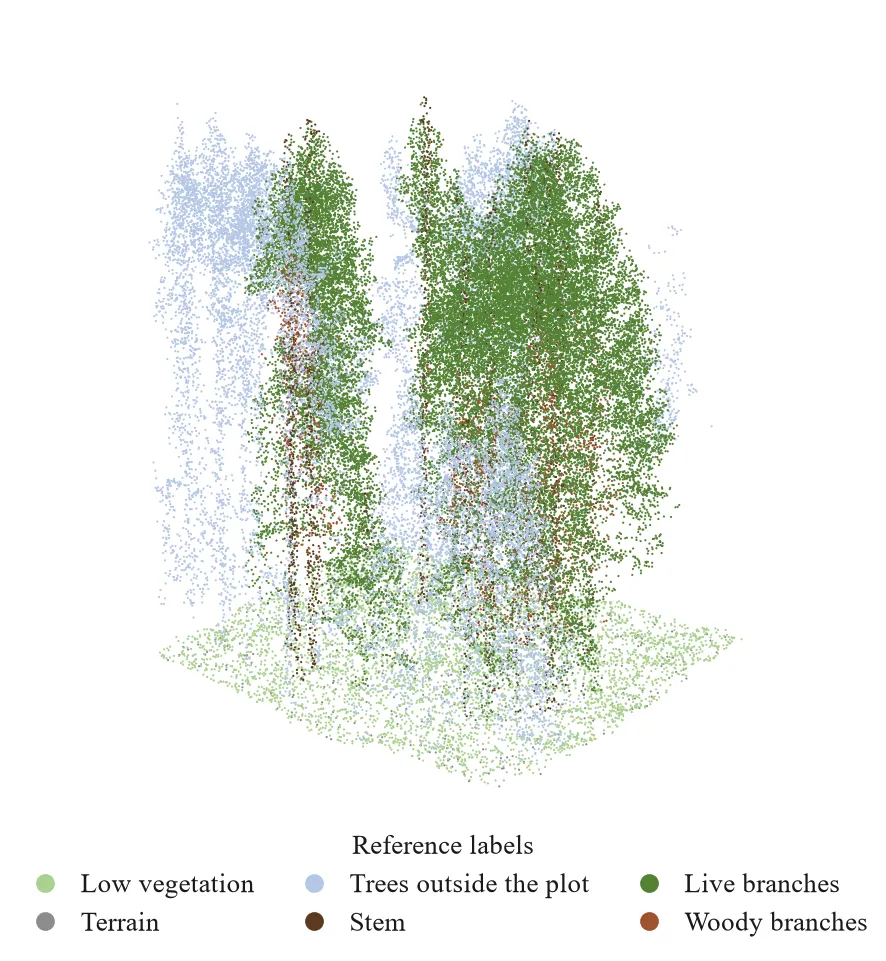
A 20 × 20 m crop of NIBIO plot 10, 60,000 points, coloured by the reference labels. Data: FOR-instance, CC BY 4.0. View in 3D
Benchmark for semantic and instance segmentation of individual trees from UAV laser scanning.
FOR-instanceV2 Sensor other · UAV, mobile and terrestrial laser scanning Region 9 collections in 6 countries Size 94 plots (48 / 17 / 29 split), 613.9 M points, 12.3 GB Labels Semantic (ground, wood, leaf) and tree instances Licence GPL-3.0-or-later (as listed on Zenodo) Paper ForestFormer3D: A Unified Framework for End-to-End Segmentation of Forest LiDAR 3D Point Clouds Download ForestFormer3D code
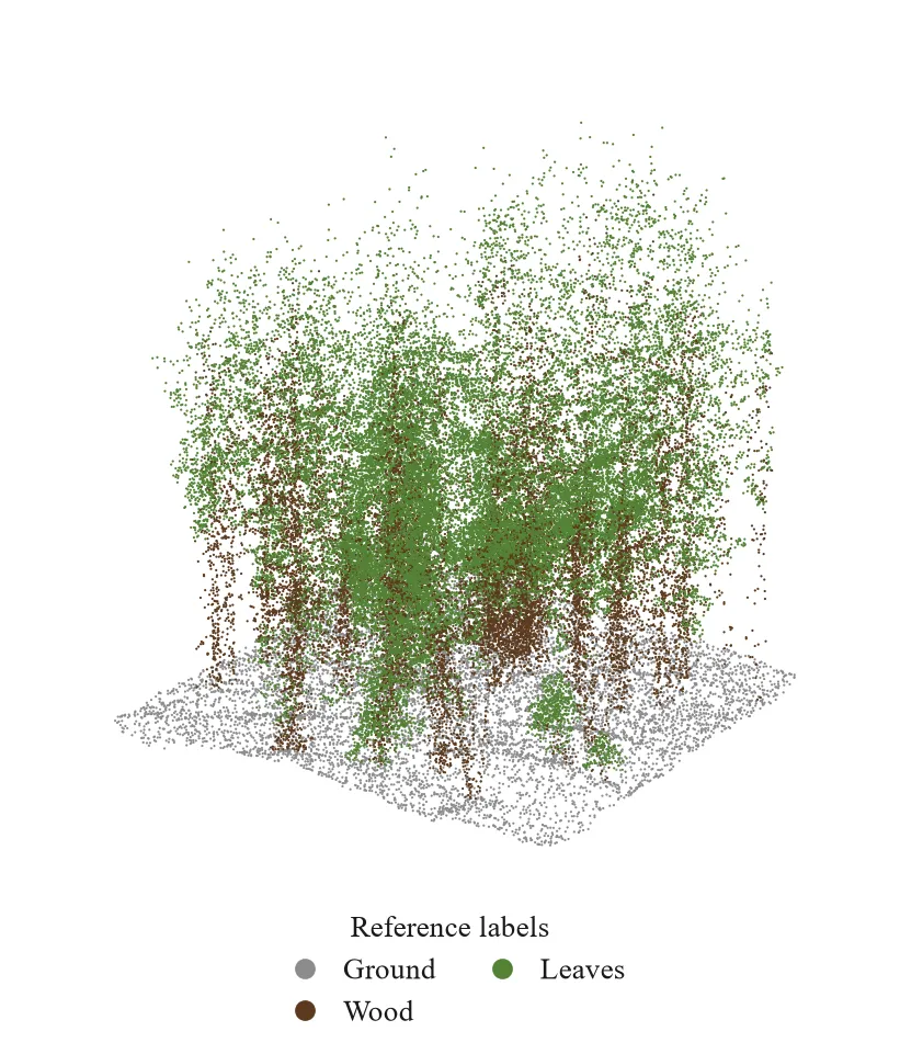
A 20 × 20 m crop of NIBIO mobile laser scanning plot 56, 60,000 points, coloured by the reference labels. Data: FOR-instanceV2, GPL-3.0-or-later as listed on Zenodo. View in 3D
Released with ForestFormer3D together with the pre-trained model. The BlueCat TLS collection holds most of the points.
ForestSemantic-MS Sensor ALS · Multispectral helicopter LiDAR (SWIR, NIR, green) Region Finland (boreal forest) Size 6 plots, 0.7 ha, 9.6 M points, 131 MB Labels Foliage, ground, low vegetation, branches, trunk, woody debris Licence CC BY 4.0 Paper 3D Forest Semantic Segmentation Using Multispectral LiDAR and 3D Deep Learning Used in Notebook 01: PointNet and PointNet++ baselines on ForestSemantic-MS , Notebook 02: sampling retention gate Download
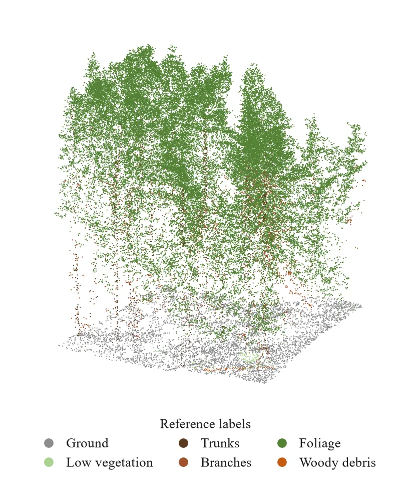
A 20 × 17 m crop of test plot 1, 60,000 points, coloured by the reference labels. Data: ForestSemantic-MS, CC BY 4.0. View in 3D
Official split: four training plots and two test plots, with no validation plot.
LANDFIRE fuel layers Sensor other · Raster fuel layers (FBFM40, canopy base height, canopy bulk density) Region United States (local copy: LF2016 clipped to the 2021 Caldor fire) Homepage Fire perimeters (NIFC open data)
LAUTx Sensor MLS/PLS · Handheld personal laser scanning (GeoSLAM), leaf-off, March 2019 Region Lower Austria Size 6 plots, 515 manually segmented trees Labels Individual tree point clouds; measured crown base for 489 trees Licence CC BY 4.0 Download Extended Wytham + LAUTx scenes (GRO.data)
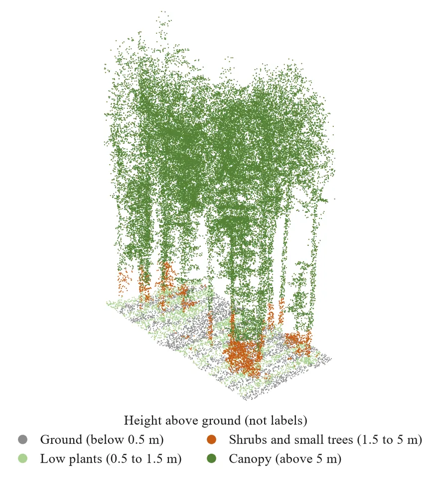
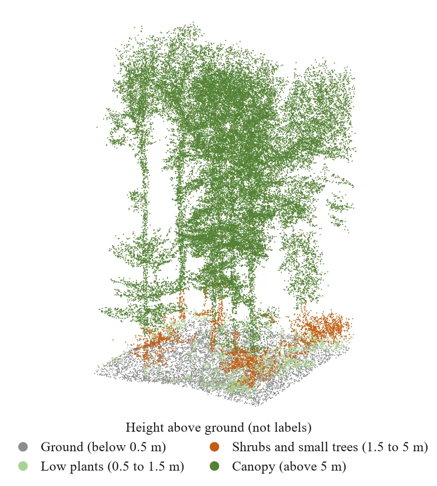
A 20 × 20 m crop of plot p14 from the extended LAUTx scenes, 60,000 points, coloured by height above ground in the project's layer bands (not labels). Data: extended Wytham and LAUTx scenes (GRO.data), CC BY 4.0. View in 3D
Ground reference for the HELIOS++ hide-and-check test.
NASA FIRMS active fires Sensor satellite · MODIS / VIIRS active fire detections Region Global (local copy: Sri Lanka, MODIS 2015–2024) Homepage
TreeLearn dataset Sensor other · Ground-based LiDAR forest point clouds Labels Individual tree instances (benchmark plot L1W) Licence CC BY 4.0 Paper TreeLearn: A deep learning method for segmenting individual trees from ground-based LiDAR forest point clouds Download TreeLearn code
A 20 × 20 m crop of benchmark plot L1W, 60,000 points, coloured by height above ground in the project's layer bands (not labels). Data: TreeLearn dataset (GRO.data), CC BY 4.0. View in 3D
WildForest3D Sensor ULS · UAV LiDAR, about 60 pulses per square metre Region Aquitaine, France Size 29 plots, 7.0 M points Labels Tree id per point; 1,570 trees with species and size; 0.5 m layer rasters (coverage, height, whether determinable) Licence Not stated (no licence file in the repository) Paper Multi-Layer Modeling of Dense Vegetation from Aerial LiDAR Scans Download Homepage
The main training dataset of the thesis. In the two lower layers most raster cells are marked undetermined, so the lower-layer answer key is sparse.
Wytham Woods TLS Sensor TLS · RIEGL VZ-400 terrestrial laser scanning, leaf-off, Dec 2015 – Jan 2016 Region Oxford, United Kingdom Size 1.4 ha plot, 876 tree point clouds Labels Individual trees and quantitative structure models (QSMs) Licence CC BY 4.0 Download Extended Wytham + LAUTx scenes (GRO.data)
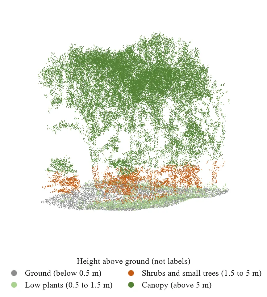
A 20 × 20 m crop of the Wytham Woods scene from the extended scenes, 60,000 points, coloured by height above ground in the project's layer bands (not labels). Data: extended Wytham and LAUTx scenes (GRO.data), CC BY 4.0. View in 3D
Ground reference for the HELIOS++ hide-and-check test.